


 Interactive maps & GIS
Interactive maps that handle real data.
Store locators, property search, asset tracking, coverage and GIS. We build custom maps in Mapbox, Google Maps and MapTiler, picking whichever fits your data, your budget and the volume you expect.
- Mapbox, Google Maps or MapTiler
- Handles large datasets
- Styled to your brand


What is an interactive map?
An interactive map is a map embedded in a website or application that users can pan, zoom, search and filter, with your own data drawn on top of the base map.
A static image of a map answers one question. An interactive map answers the question the visitor actually has: where is the nearest one, which of these meet my criteria, what does this area look like. The work is rarely the map itself. It is the data behind it, kept fast enough to stay usable when there are fifty thousand points rather than fifty.
- Your data on top
- Locations, parcels, assets
- Fast at scale
- Clustering and tiling
- Styled to match
- Not a default blue map
What a custom map does.
Beyond dropping an embed on a contact page.
-
Looks like your brand
Base map styled in your colours instead of the default everyone recognises.
-
Search and filter together
Visitors narrow by what matters (type, size, status, distance) and the map keeps up.
-
Handles real volume
Clustering, vector tiles and server-side queries keep tens of thousands of points responsive.
-
Works on a phone
Touch targets, gestures and performance tuned for the device most people use.
-
Connects to your systems
Reads from your database or CMS, so the map is never out of date.
-
Choose the right provider
Mapbox, Google Maps and MapTiler all have strengths. We are not tied to one.
Mapbox, Google Maps or MapTiler?
A short, honest comparison of the three we build with most.
| Area | What it is best at | What to watch |
|---|---|---|
| Mapbox | Deep styling control and strong vector performance | Pricing climbs with heavy map loads |
| Google Maps | Unbeatable place data, Street View and familiarity | Harder to restyle, and the look is recognisable |
| MapTiler | Open data, self-hosting and predictable costs | Smaller ecosystem of ready-made extras |
| Large datasets | Vector tiles and clustering on any of the three | Naive marker rendering will crawl |
| Offline or air-gapped | MapTiler can be self-hosted | Mapbox and Google need their services |
| Our default | Mapbox for most custom work | Google when place data is the point |
What a mapping project covers.
From a store locator to a full GIS interface, the shape is the same.
Get a quote- Data review What you have, what shape it is in, and what it needs to become.
- Map styling Base map designed in your brand colours, with the right detail at each zoom.
- Markers and layers Points, polygons, heat and routes, designed to stay legible together.
- Search and filtering Address search, radius, and filters that work with the map rather than beside it.
- Performance work Clustering, tiling and query tuning so it stays fast at full volume.
- Mobile experience Gestures, sheet-style detail panels and touch targets that work.
- Data pipeline Connected to your database or CMS so the map updates itself.
Custom mapping suits…
-
Multi-location businesses
Store and clinic locators that actually help people choose.
-
Property and land
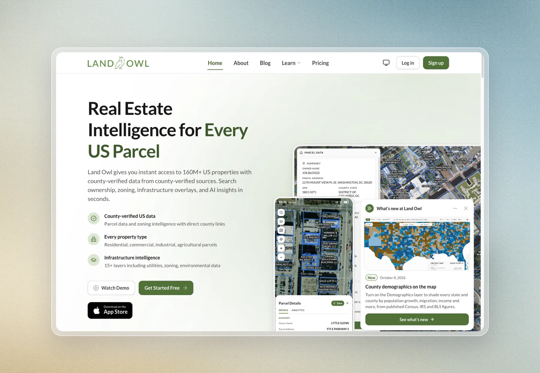
Parcel, listing and development data people need to explore.
-
Infrastructure and energy
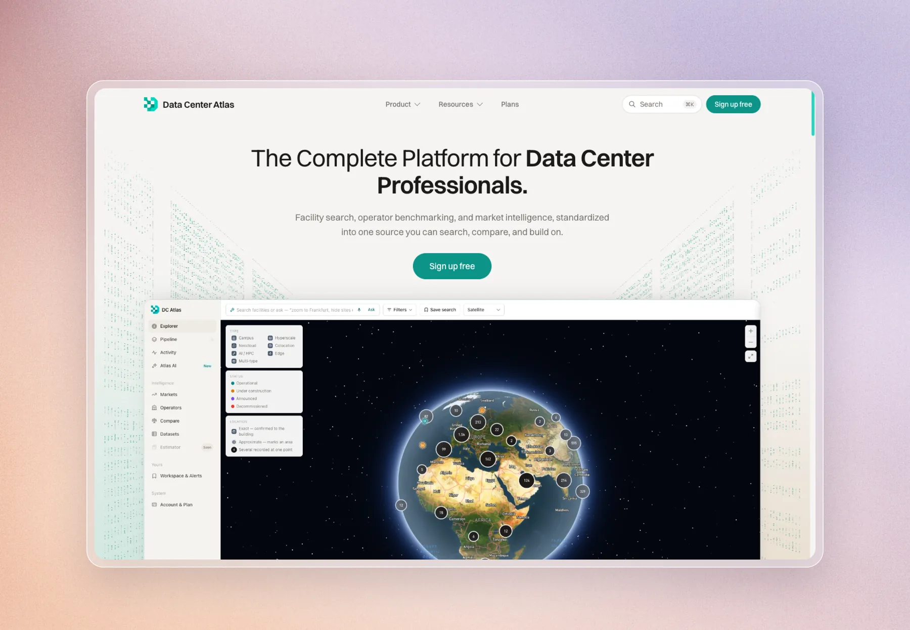
Assets, networks and coverage across a region or a continent.
-
Logistics and field teams
Territories, routes and job locations, live.
Projects built this way.
Platforms where the map is the interface, not a decoration.

Explore our other services.
Updated
Interactive maps & GIS FAQs.
The questions we get asked most about interactive maps & gis.
Ask a question
Which is better, Mapbox or Google Maps?
It depends what the map is for. Google Maps wins when you need place data, Street View or the interface everyone already knows. Mapbox wins when you want the map styled to your brand and heavy custom data layers. We pick per project rather than defaulting to one.
How much does an interactive map cost to build?
A styled store locator starts in the low thousands. A full data interface with search, filtering and large datasets costs more. Running costs depend on the provider and your traffic, which we model before choosing.
Can you put our existing data on a map?
Yes. Spreadsheets, GeoJSON, shapefiles, a database or an API. We work out what cleaning and geocoding it needs, then build the pipeline so it stays current.
How many locations can an interactive map handle?
Tens of thousands, built properly. The techniques that matter are clustering, vector tiles and querying server-side rather than shipping every point to the browser.
What is MapTiler and when would we use it?
MapTiler is a mapping platform built on open data that can be self-hosted. It suits projects with predictable cost requirements, or where the map has to run inside your own infrastructure.
Will the map work on mobile?
Yes, and it is designed for it first. Gestures, touch targets and sheet-style detail panels all need deliberate handling on a phone.
Can the map connect to our CMS?
Yes. Locations can live in your CMS so your team edits them like any other content, and the map reads from it directly.
Custom Astro websites. Built on Cloudflare.
Plyo Studio is an independent web studio that designs and builds fast, search-ready websites, web apps and interactive maps. Sites are custom-built in Astro and hosted on Cloudflare, so they load quickly and are easy for search engines and AI answer engines to read.
Founded by Chloe Nixon, a full stack developer and UI/UX designer from Australia, and Micky, a software engineer from New Zealand. Clients work directly with the founders from the first call to launch. Typical work: custom websites, migrations off Webflow, WordPress, Wix and Squarespace, web apps, and interactive maps and GIS. Projects are quoted at a fixed price before work starts.